EUREGIO Border Tours
com.outdooractive.charlemagne
View detailed information for EUREGIO Border Tours — ratings, download counts, screenshots, pricing and developer details. See integrated SDKs and related technical data.
- No items.
Screenshots

Description
Are you looking for a variety of idyllic walking and cycling routes in the border triangle of Belgium, Germany and the Netherlands or are you looking to explore the boundless possibilities of the EUREGIO? Then you are exactly in the right place!
The attractive border region in the much-loved triangle of the three countries offers visitors and local residents ever-changing landscapes and an exciting range of places to discover. The undulating countryside of Southern Limburg, the High Fens, the Eifel National Park and the almost endless variety of landscapes left behind by mining and the industrial past are waiting to be explored, alongside numerous areas of idyllic natural beauty. The unifying element in all of these routes is the idea of crossing national boundaries, planning leisure time activities that go beyond the borders of a single country and as such encourage international openness.
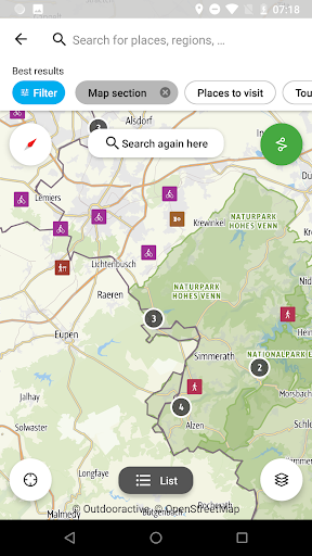
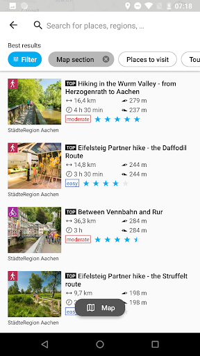
The EUREGIO Border Tours app offers all this and more:
- selected route suggestions for walkers and cyclists
- interesting places to visit in the border region
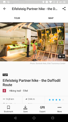
- detailed descriptions and useful information (including pictures) about the various routes and must-visit locations
- content in four languages (German, English, French, Dutch)
- zoomable topographical maps
- GPS-based location finding and orientation
- offline storage of routes and maps
If you have already completed all the pre-planned routes, or are simply looking to be creative, then why not use the route planner integrated in the app to prepare your own personal route for a completely individual experience? We hope you enjoy being a route finder!
Information and maps for each of the routes can be stored in online mode for offline use, as and when required. While out on tour you are no longer limited by network reception. We recommend using the online version of the app only in case of a mobile data flat rate, or a WLAN environment.
This app was developed as part of a tri-national tourism promotion project. The partners involved in the project represent Germany, the Netherlands and Belgium. The German partners are the tri-national lead partner AG Charlemagne Grenzregion and Grünmetropole e.V. The contributing Dutch partners are the Stadsregio Parkstad Limburg and the Stichting Visit Zuid-Limburg, and from Belgium the Eastern Belgium Tourist Office and the Agence de Développement Local Lontzen.
This microproject was developed as part of the People to People Interreg V-A EMR project, funded by the European Regional Development Fund (ERDF) and co-financed by AG Charlemagne Grenzregion. Charlemagne Grenzregion is a partnership of local authorities and institutions throughout the border region including the city of Aachen, StädteRegion Aachen, Parkstad Limburg, the Municipality of Vaals, the Municipality of Heerlen and the municipalities of Eastern Belgium.